Meet Report: 27 May – 3 June 2023.
The Wicklow mountains are the hills nearest Dublin and form the largest area of upland in Ireland, the highest point being the Irish ‘Munro’ of Lugnaquillia (925m). The Wicklows encompass many granite peaks, with classic post-glacial topography i.e. deep glaciated valleys, dramatic corries and mountain lakes with plenty of remote moorland and thus has had National Park status since 1991.
A select group of members, all visiting the region for the first time, enjoyed an excellent week based at the Irish Mountaineering Club’s hut in Glendalough on the Eastern side of the Wicklows near Laragh. The party had the hut to themselves all week. Settled high pressure brought a week of continuous sunshine, blue skies and a somewhat chilly wind on the summits, but waterproofs and gaiters remained at the hut all week. The bright, warm conditions kept the midges at bay except for early morning and the evenings when they were out in force around the hut.
Apparently over ½ million visitors come to Glendalough each year to see the monastic remains, visit the lovely valley or take walks on the hills. In addition, the proximity to Dublin brought weekend visitors too but it was fortunately much quieter during the week. That said, the Wicklow hills get a lot more attention than the other Irish mountain groups that the Club has visited over recent years.


Seven different routes were walked across the range and one included a short impromptu scramble. We were armed with 1-25k OS Ireland and 1-40k Harvey paper topo maps, but OpenStreetMap on a phone and/or GPS device was much more comprehensive at showing paths on the ground with appropriate labelling which were not included on the two topo maps.
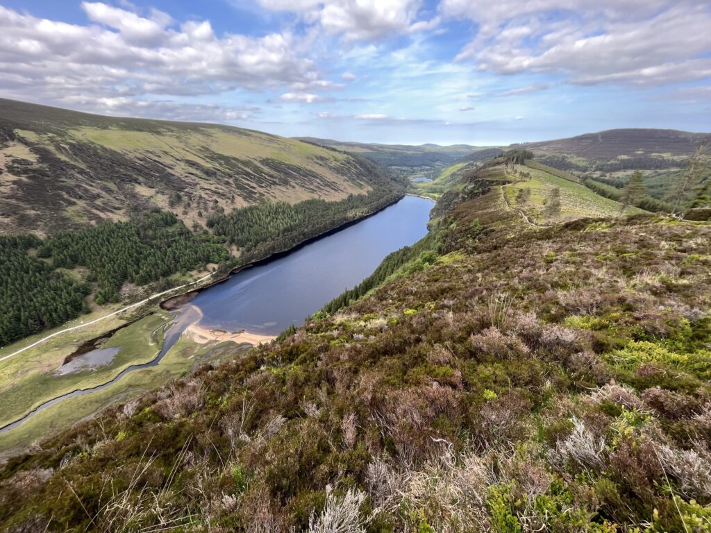
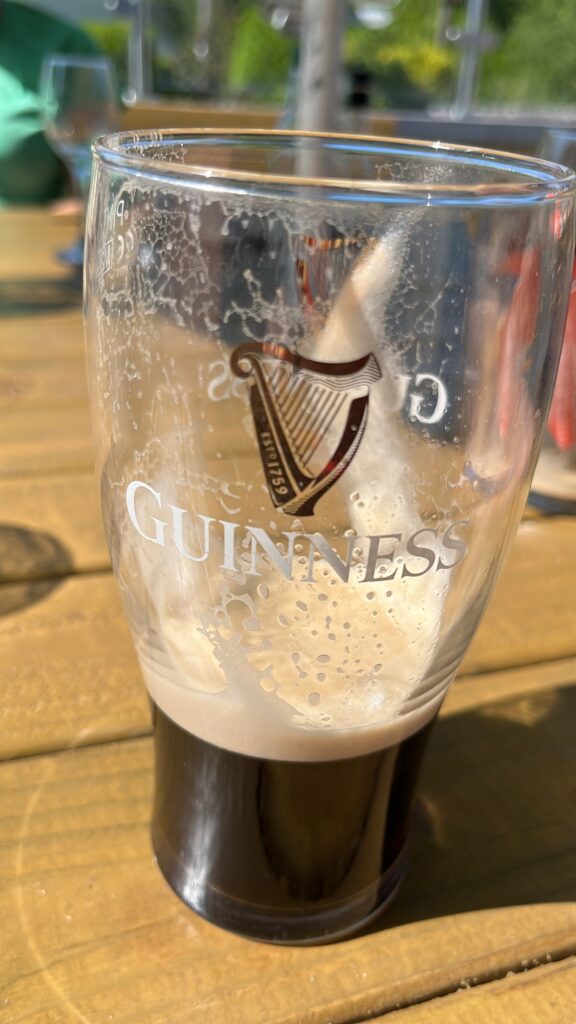
Sat 27 May After a flat calm crossing from Holyhead, Mick, Tim and Conrad drove south from Dublin encountering slow moving traffic on the motorway and crowds of people enjoying the sunshine and the bars in Laragh. After settling into the hut, which was otherwise empty, they did a late afternoon walk from Glendalough up through the old oak woods and a felled plantation up to the rocky Spinc ridge which overlooks the two glacial lakes in the valley. On the return they visited the monastic city with its impressive 30m high round tower (a campanile), built a thousand years ago and an extensive graveyard near the cathedral ruins


. By the time they reached the hut after a refreshing Guinness in Laragh, Pete and Anne had already arrived by bike from Cronybyrne, where they had stayed overnight in a traditional travellers’ caravan, about 8 miles from Laragh.
Sun 28 May Given the number of people around, they all decided on one of the potentially less popular walks where parking would hopefully not be a problem and chose a round of Scarr and Kanturk from Oldbridge near Lough Dan. This proved to be a wise choice as they parked in the last place in the layby. These mid-height hills are centrally located and supplied with good 360 degree views in the sunny weather.


Mon 29 May – David Herman’s guidebook to the Wicklows suggested a dozen different routes up ‘Lug’, but they chose the one claimed to be the most scenic which went up the Faughan Rock Glen from Glenmalure. Walking into the forested valley they saw the first of many Sika deer, this one was surprisingly inquisitive and was happy to have its photo taken at close quarters. The route provided good views of all three of ‘Lug’s’ rocky corries as well as the expected panorama. On their descent from the summit, they encountered a brand new sign informing walkers that access was denied to the main Glenmalure Zig-Zag path after an assault on the landowner by a walker determined to take his two dogs with him despite this not being allowed. Fortunately their descent route via Art’s Lough was not at issue.


Anne and Pete cycled from the IMC hut down to Laragh and then up the Glendalough valley on the Miners’ Road as far as the lead mine ruins. Locking their bikes up, they then ascended the path as far the footbridge over the Glenealo River and returned via the monastic city.
Tue 30 May With Tim off on his bike, the others decided to walk directly from the hut on a lovely circuit taking in the two valleys on either side of Camaderry. Both the Glendasan and Glenealo valleys have been extensively mined for lead and zinc since the early 19th century and reworked in the 1950s. The mines were connected by a tunnel under Camaderry. The Wicklow lead-bearing veins all occur in granite giving a very different landscape to that seen around the Yorkshire Dales lead mines, but the same technology was used. Lunch was taken near the upper reservoir of the Turlough Hill pump storage hydroelectricity scheme with far-reaching views across to Lugnaquilla. Several large herds of sika deer were grazing at the head of Glenealo and the stream was followed down past the mine ruins to the Miners’ Road and back across the stepping stones to the hut.


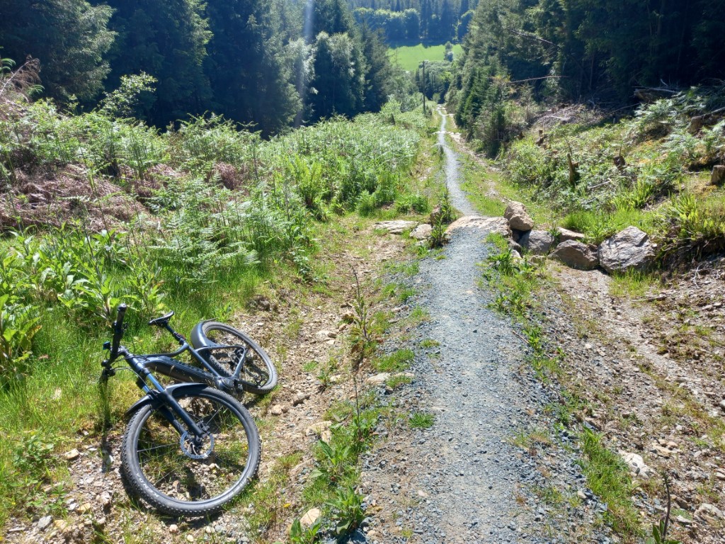
Tim drove to Glenmalure to ride a circuit to the South along the Wicklow Way, returning via forest tracks. The start, a 500m ascent up steep forest tracks was brutal. Worse was to come, after about 7km the way was blocked by forestry work. After a couple of hours casting about, including 1km on a narrow wooden causeway he found himself well off route and only 9km from the start. Returning to the car he found a small road that accessed the circuit a bit further on. The rest of the way proved rather monotonous, mostly in forest plantations and he eventually arrived back at the car after 65km and over 1800m of climbing. The battery was flat!
Wed 31 May Pete and Anne needed to start their journey to Dublin to catch the Holyhead ferry and Conrad was doing some genealogy research in Wicklow, so Tim and Mick headed up the Military Road out of Laragh to walk the round of the Barnacullian Ridge and Tonelagee. It was varied for a number of reasons. A long and pleasant saunter beside the Glenmacnass River slowly gained height and led to an all-too-short scramble up granite slabs beside the infant river. The lengthy ridge from Barnacullian led to a truly vast desert-like expanse of exposed peat dotted with vegetation-topped peat hags and they were glad that it was dry underfoot. Tonelagee was blessed with a fine view to the romantically heart-shaped Lough Ouler.


Thu 1 June Tim was biking again, so Mick and Conrad set off on a walk taking in the summits of War Hill and Djouce. A section of the Wicklow Way was followed over White Hill with a superb view across to Lough Tay nestling below Luggala. They followed the Way down to Glensoulan and its junction with the Dargle River. The up-valley path indicated on the OSM map could best be described as a discontinuous assortment of deer tracks through bracken and heather – it certainly didn’t see much footfall. Once on War Hill the going became a lot easier and the rocky tor at the summit of Djouce was soon underfoot, returning over White Hill.


Tim accompanied Conrad and Mick to their car park and cycled down to Ballinastoe mountain bike centre near Powerscourt where he completed a purpose built trail before setting off to follow the Wicklow Way back to Laragh. In this he was thwarted by peremptory signs threatening prosecution to anyone daring to cycle along the wide forest tracks. Still the ride to Laragh along quiet lanes was pleasant. Over a lunchtime coffee a local cyclist told him that basically off road riding is illegal in Ireland. However the advice was to ignore all that, “Sure you’ll be fine!” So in the afternoon Tim followed beautiful trails through ancient oak and beech forest along the Avonmore river. Well worth the risk of incarceration.


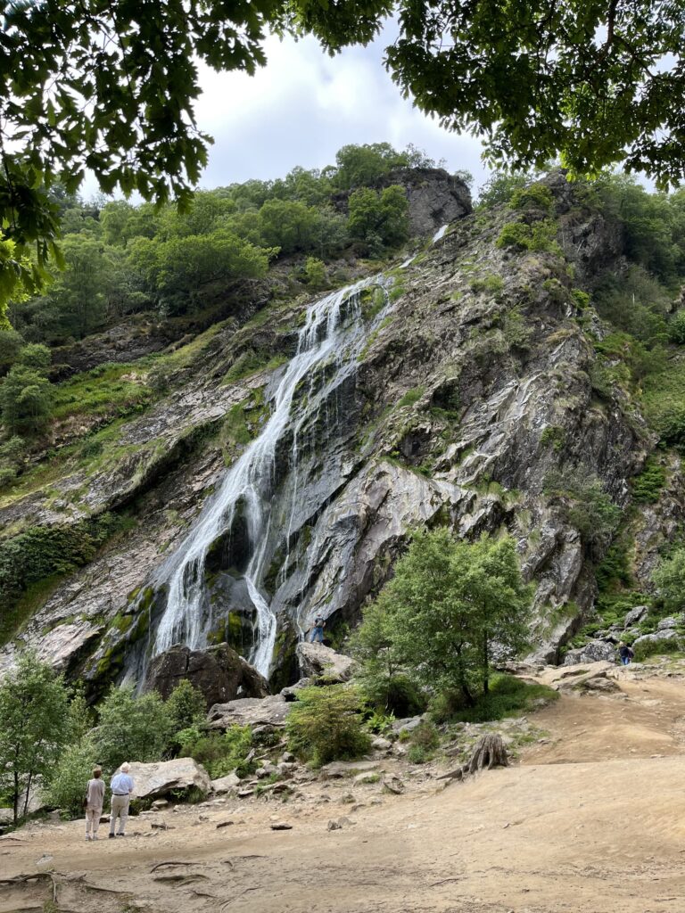
Fri 2 June The original intention was to ascend Luggala by a scrambling route up its impressive Eastern corrie above Lough Tay, but unfortunately the estate was closed for the day, so two shorter routes from the guidebook were combined. Starting from Crone, the lovely deciduous woods of the Powerscourt Estate were crossed to the foot of the 121m high Powerscourt waterfall, claimed to be the highest in Ireland. After following the Dargle River downstream, a steep ascent through trees led to another short section of the Wicklow Way and then a path across the open fellside to Maulin. A descent through the plantations completed the last walk of an excellent week.
Attendees: Mick Borroff, Tim Josephy, Anne and Pete Latham, and Conrad Tetley.
Hi there, I hope you’re well. I’m planning an exhibition with the Wicklow Library this May based on my citizen heritage project, and I was wondering if I could please use your photo of the cross-inscribed standing stone on Tonelagee as part of one of the posters? My plan is to have a local Wicklow artists draw illustrations of the associated myths on photos of the heritage sites, and I would love to use yours please. Of course you would be credited for your photo on the poster, and I’d like to stress that this project is 100% volunteer based, and is not funded by any bodies. Please respond at your earliest convenience. Thank you!
Hi Isabel, I have sent you a separate email giving this approval plus a full sized image.