Meet Report: 28 July – 11 August 2018.
![]()
Week 1 – Padis Plateau
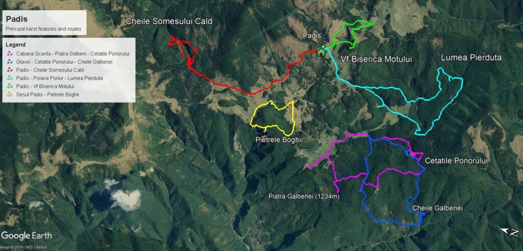
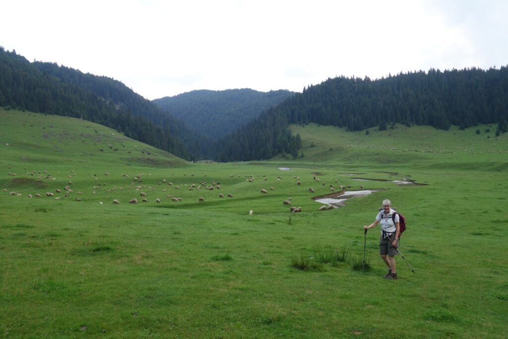
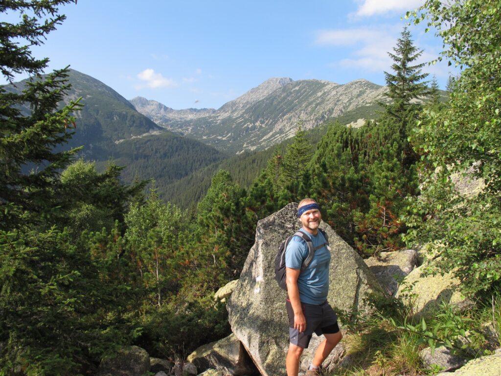
The first part of the meet was spent on the Padis plateau in the Apuseni Mountains. Also called the Bihor or Bihar Mountains, this karst region in the Western Carpathians has rolling forested hills studded with caves and potholes. The settlements in this Natural Park are traditional villages and their flocks of sheep are taken onto the hills for summer grazing under the ever-watchful eyes of the shepherd and his dogs. The plateau altitudes are medium, (1300-1500m).
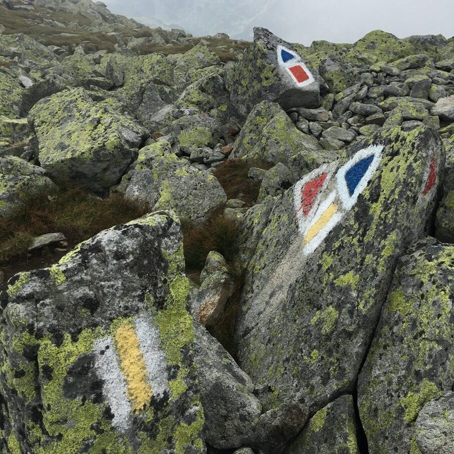
The Padis plateau is famous for its karst features, caves, springs, sinkholes, deep dolines and limestone gorges. These formed the focus of our objectives over the week as we made day hikes from a comfortable base in the Padis hamlet. Most paths were well signed and waymarked.
28th July: Arrival in Padis
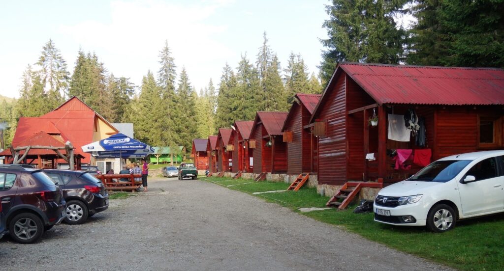
Mike and Helen Smith arrived at Padis in the afternoon, Richard Smith and Tim Josephy, having ignored all advice had come up via the short cut forest road (about 70 km shorter than the recommended route). They didn’t save much time though as the last 10km were traversed at walking pace through deep potholes and bouldery tracks. As night fell they couldn’t help imagining what might be lurking in the forest, bears or something much more ancient? It is Transylvania after all. They made it with a strong smell of hot clutch and all settled into a basic but comfortable 4 bed cabin, one of a dozen or so on the site.
29th July: Padis – Groapa de la Barsa walk
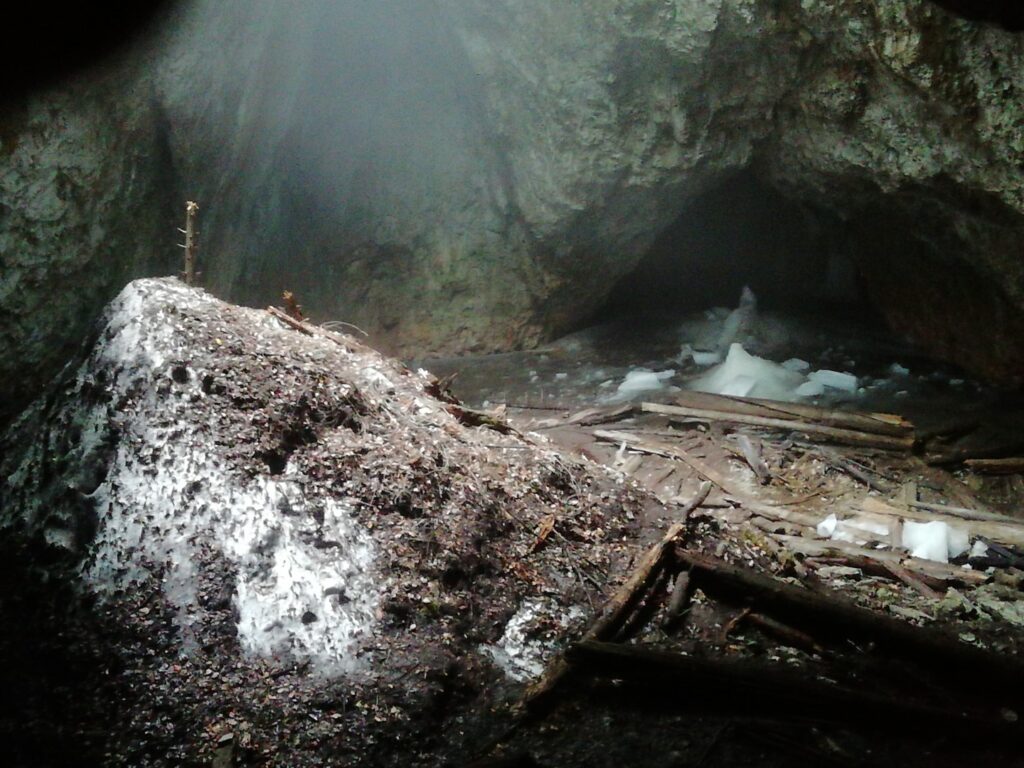
The Smiths and Tim walked from Padis down to a delightful camping area at Glavoi where coffee was to be had. They then climbed up onto the Groapa de la Barsa, an area of mainly deciduous forest with a multitude of caves. One, Ghetarul de la Focul Viu, or The Living Fire Cave is a massive chamber lit from a shaft in the roof and containing a massive ice boss and a number of columns. The ice is said to date from the last ice age. Entry into the chamber is forbidden but a descent of about 20m to a balcony is permitted. The temperature gradient from the warm and humid surface to the zone of ice was astonishingly rapid. Rumbles of thunder accompanied the afternoon return, but the rain held off and they got back dry to await the arrival of the others.
30th July: Padis – Cheile Somesului Cald walk
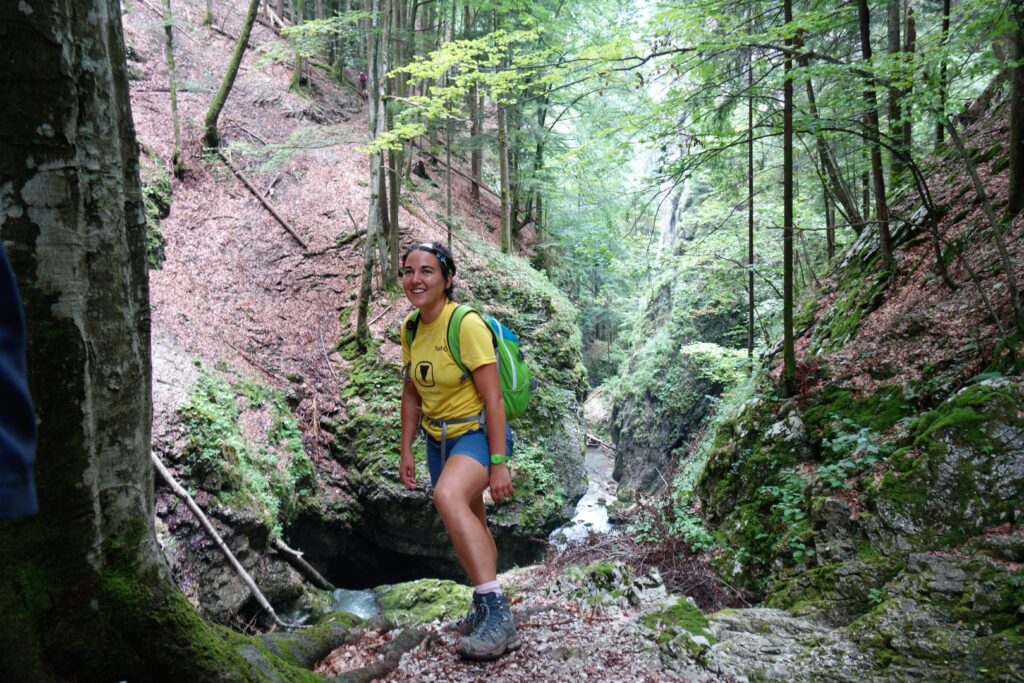
We all (The Smiths, Tim, Anca Pordea, Jason Lees, Richard Taylor and Mick Borroff) decided to start with a varied route to the north of Padis involving a spot of caving. We headed through predominantly spruce woods to Cabana Varasoia and then across open grassland to reach the entrance of Radesei Cave via a steep path with fixed chains.
Having put our head-torches on, we traversed the cave via a system of ledges above the stream, aided with more chains, which led down into a narrow sunlit gorge after a couple of hundred metres.
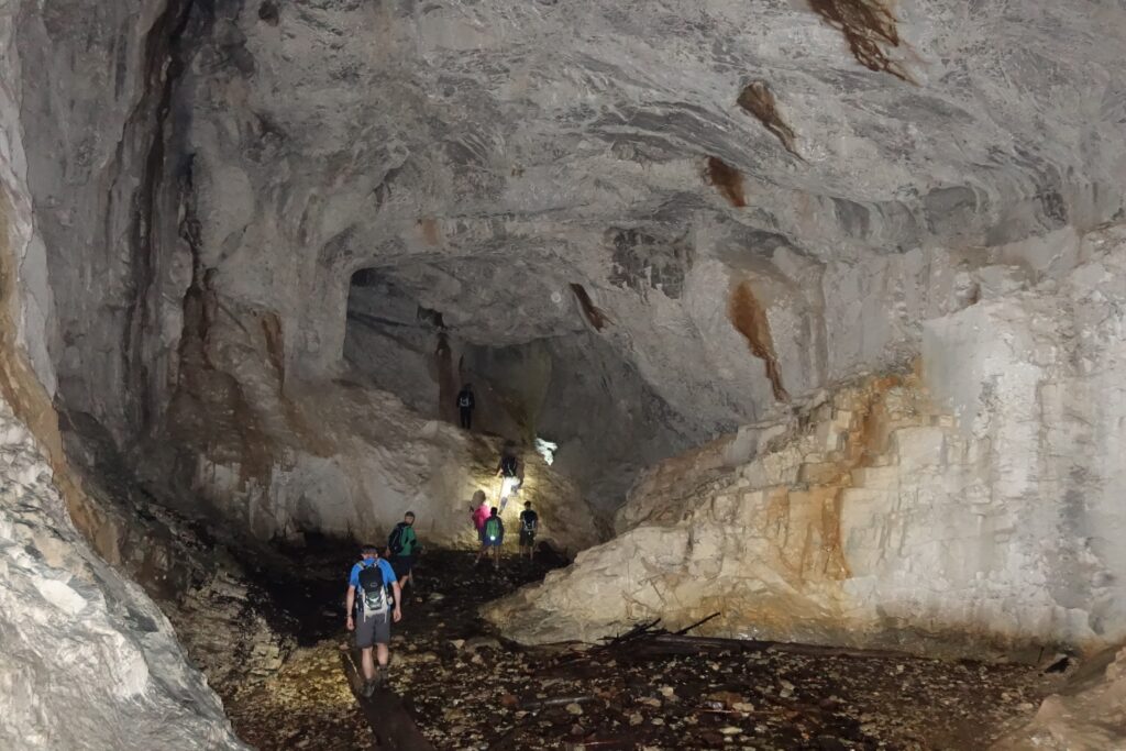
This led to the start of the main Somesului Cald gorge. We tried to descend this, but the way was soon obstructed by a deep pool and no one wanted to get their boots soaked on the first day out. The main path had been hit by a severe storm in 2017 which had felled numerous trees, which had not been cleared and the path was officially closed. However, others had forced an energetic way over and under the tree-fall. We stopped for lunch at a belvedere far above the gorge and eventually arrived at the downstream crossing point.

Approximately 1½ km had taken us nearly two hours! Fortunately, the north bank had not suffered so much in the storm and we quickly climbed back through beech woods and returned to the downstream cave entrance, where we met a Romanian party who were impressed by our efforts. We returned to Padis by the same route for a well-earned beer.
31st July: Padis – Poiana Ponor – Lumea Pierduta walk
Anca’s sister Dana and her partner Sorin had arrived, so Anca and Jason spent the day with them walking locally.
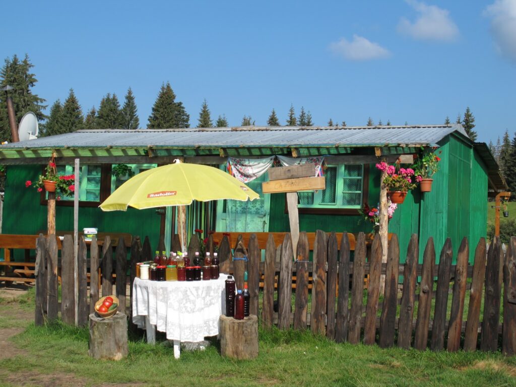
The rest set of from the cabins down through a muddy track past several summer huts offering various fruit cordials and distilled liquors for sale.
We descended steeply into Poiana Ponor – a large grassy depression (a polje).
This was fed by a river emerging from the Ponor spring which we followed until it disappeared into a sinkhole to join the Ponorului system. Here a large party of Romanians were having single rope technique practice on the cliffs as part of a week-long caving course. We stopped for coffee at the Cabana Cetatile Ponorului, a mountain hut run by the Romanian Speleological Association. A forest track led to the climb up to Lumea Pierduta – the Lost World. This is a dense area of mainly beech woods, with several impressive cave entrances hidden in the trees, but linked by a well waymarked path, eventually leading back to Padis.
1st August: Cabana Scarita – Groapa de la Barsa – Piatra Galbenei – Cetatile Ponorului walk and caving trip
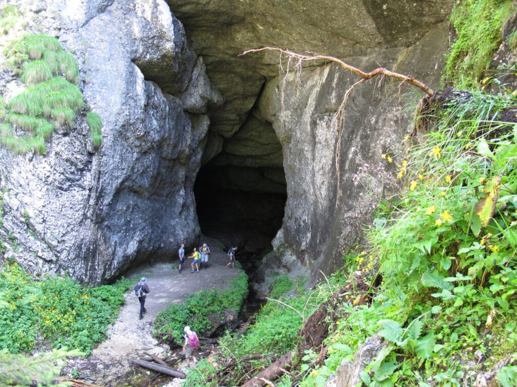
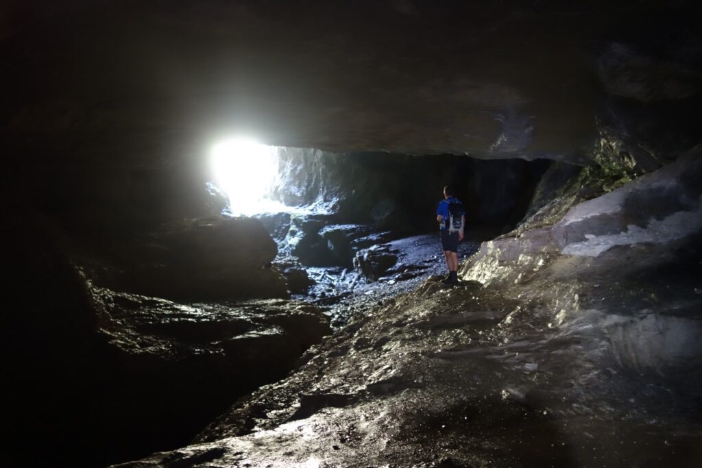
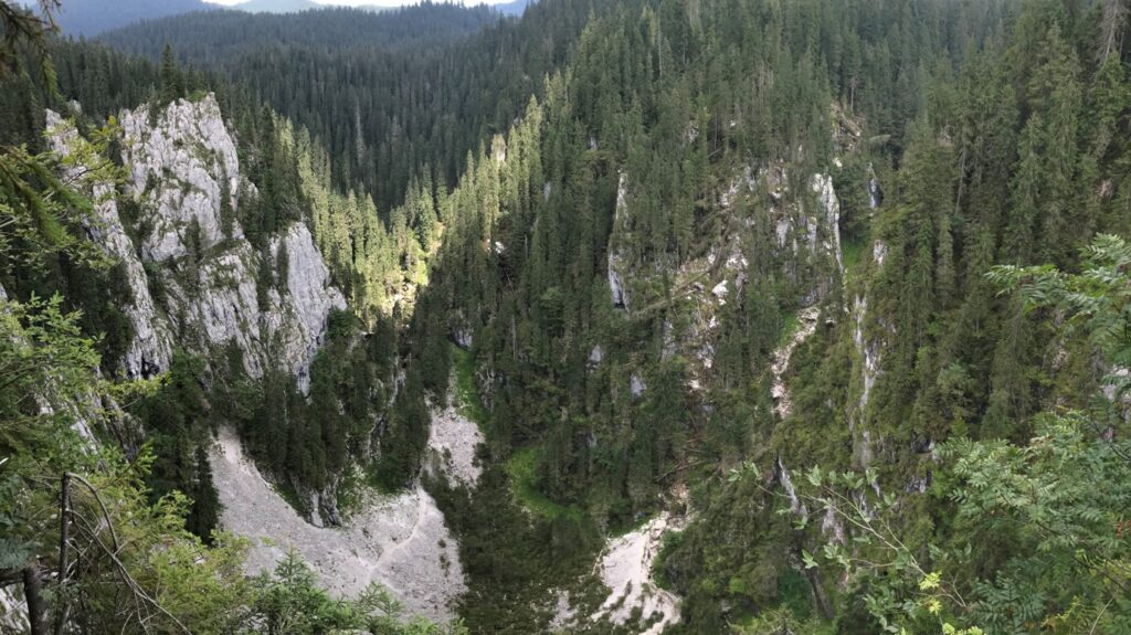
Pestera Cetatile Ponorului is the greatest karst phenomenon in Romania: three enormous sinkholes to a depth of 120m, in one is a huge cave portal at the foot of the cliffs, leading to a large underground river linked to another entrance. Four exposed belvederes on the dolines’ rim provide dramatic viewpoints. Tim, Michael and Richard Smith met their two professional guides, Bogdan and Robi for a trip down this exciting river cave.
After donning wetsuits at the entrance they wandered downstream through a vast cathedral like passage to the second entrance up a steep boulder slope. The gradient steepened with a short pitch and cascades interspersed with swimming. The passage was smaller now, merely huge instead of vast. About halfway in we turned back because of worries about the forecast afternoon storms. This decision avoided the pensioners having to admit defeat. The return up the not inconsiderable river was energetic; the current in one lake was such that a rope was needed by some to make any kind of progress. Eventually all the cascades and swims were negotiated and a return to sunshine was made via the secondary entrance.
The rest of us drove to Cabana Scarita and walked over to the beech and spruce woods of the Groapa de la Barsa, visiting several cave entrances on the way. A couple of these were glacier caves having massive ice plugs. We then climbed up to the viewpoint of Piatra Galbenei (1234m) and had lunch looking out at the verdant treescape leading down to the Galbenei gorge to the south and Padis to the north. Suitably refreshed, we headed down to the Cetatile Ponorului dolines and peered over the impressive cliffs at the first viewpoint. Traversing the rim, we joined the path leading down a steep, loose and muddy slope aided by various chains to reach the doline floor next to a large cave entrance. Headlamps were donned and we descended to the river wondering if we might meet the three YRC cavers coming out (we didn’t). Returning to daylight we took the path up the scree into the second and bigger doline and were blown away by the sheer size of the 70m high cave entrance and the surrounding cliffs – Gaping Gill would fit in a small corner of this massive depression.


After trying to do justice to this with our cameras, we climbed back out by another chain assisted path and returned to the car, after refreshments at one of the Glavoi campsite cafe-shacks.
2nd August: Glavoi – Cetatile Ponorului – Cheile Galbenei
Having either seen or swum in the river in the Cetatile Ponorului caves, we were all keen to visit the Galbenei gorge to see it reappear in daylight and make the chain traverse downstream which Anca had done last year. We parked at the Glavoi campsite and walked around the northern path around the viewpoints over the Ponorului dolines.
Then up to the Bortig pothole and back down through beechwoods to the substantial rising at the head of the Galbenei gorge. The verdant path climbed above crashing waterfalls and cascades, before heading down to the river, where we traversed the left wall of the canyon on stemples and chains.
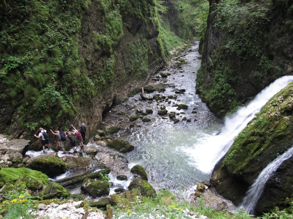
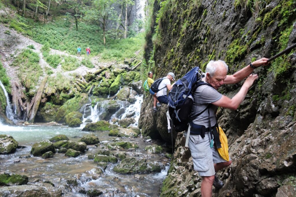
The rain started as we had lunch mid-way. We then climbed through a short section of cave and back to the stream for a final aided section leading to a car park and a long slippery climb up through wet meadows to the wooded ridge where the rain eased off and back to the car parked conveniently by one of the cafe-shacks. Some partook here of local delicacies, sweet pancakes and waffles whilst others stuck to the beer.
3rd August: Padis – Pestera Padis – Pietrele Boghii – Sesul Padis
On our last day, without Tim who had to leave, the YRC party accompanied Anca’s sister Dana and Sorin on a half day walk across the grassy meadows west of Padis and up through beeches to the superb viewpoint of Pietrele Boghii were we had lunch perched on the edge of the wild and deep Boga valley. We descended to a grassy area where peat bogs – a type of high altitude wetlands that accumulate acidic peat over a long period of time, were being formed in small depressions and walked back to the cars.
Back in Padis in the early afternoon, most people wanted a touch more exercise and opted to ascend the cross-topped hill called Varful Biserica Motului overlooking the hamlet. Mick and Richard Taylor passed several flocks of sheep and visited a small cabin where a friendly old lady was making cheese. She invited them in to taste samples of the still-warm curds of the day’s production and a more mature example taken from muslin cloths hanging in the dairy.
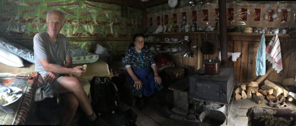
The inside of the cabin was very basic with its small stove and blackened pots and pans lining the shelves. We said our goodbyes and walked up grassy slopes to the summit shelter replete with icons of St George and the Dragon to take in the view over the Padis Plateau.
Week 2 – Retezat Mountains
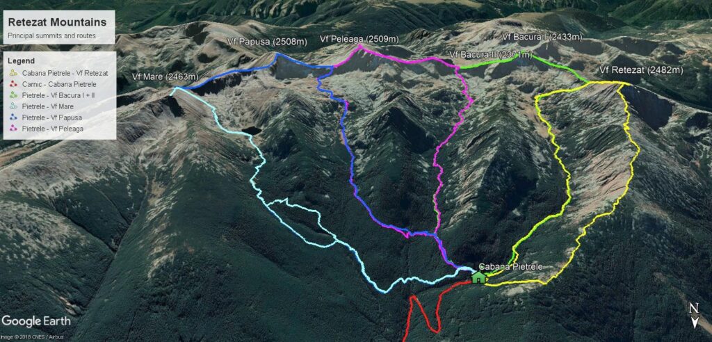
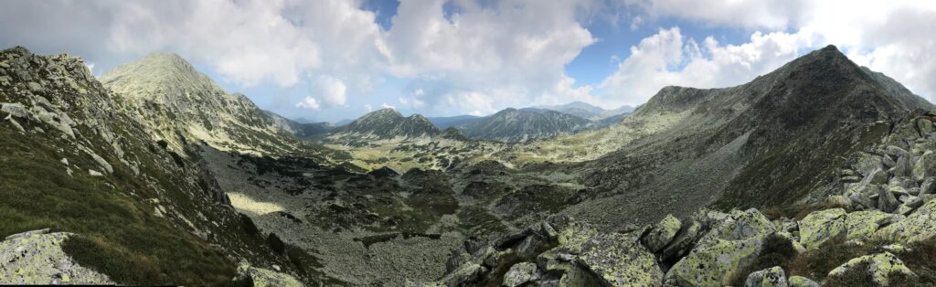
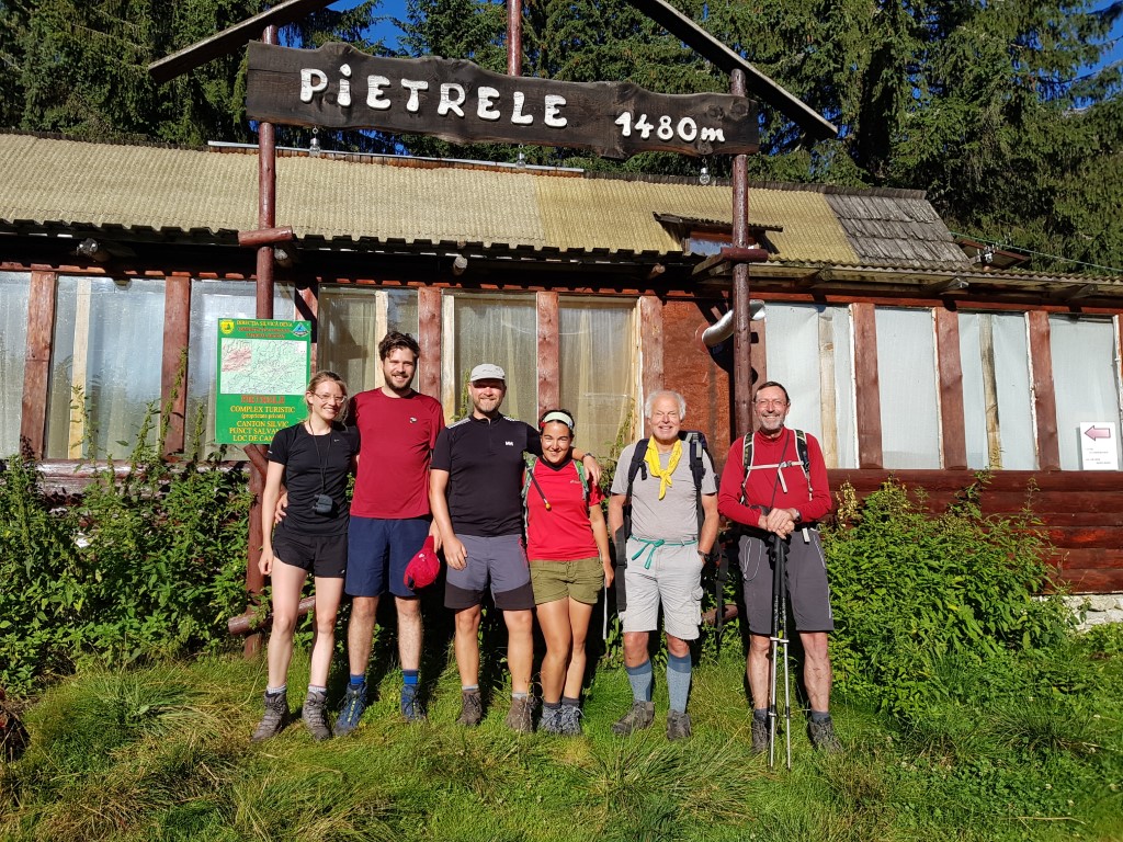
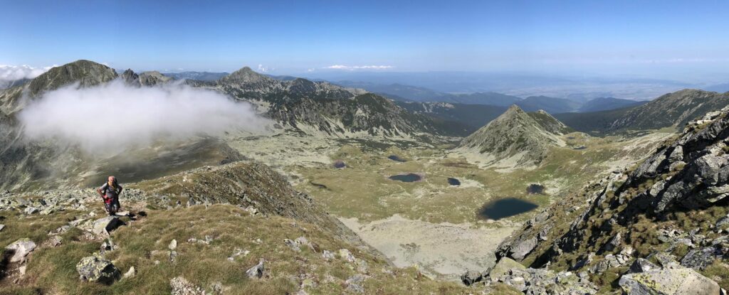
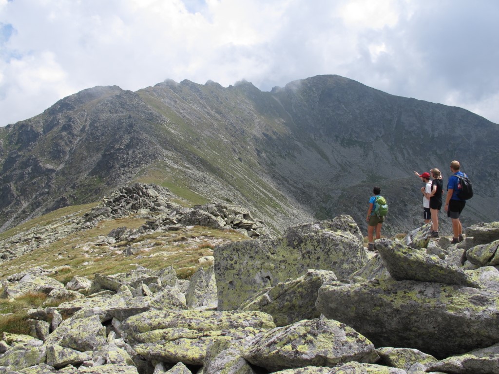
The second part of the meet was spent further south in the Retezat Mountains. This is a region in the western part of the Southern Carpathians (also sometimes called the Transylvanian Alps) with higher mountains (2200-2500m) studded with post-glacial lakes. A characteristic feature is the lichen covered granite boulder-fields. The mountains have a series of ridges and valleys extending north from the main ridge having the two highest peaks Varful Peleaga (2509m) and Varful Pelusa (2508m). From our base at Cabana Pietrele at 1480m, we had a choice of routes to access sections of the main ridge using either the valley or secondary ridge paths, such as that over Varful Retezat. These involved 1100-1300m of ascent each day. The Retezat is an unspoilt National Park, which zones of spruce fir forest and dwarf pines higher up leading to the grassy alpine pastures surrounding the glacial tarns used for summer grazing by sheep and cows.
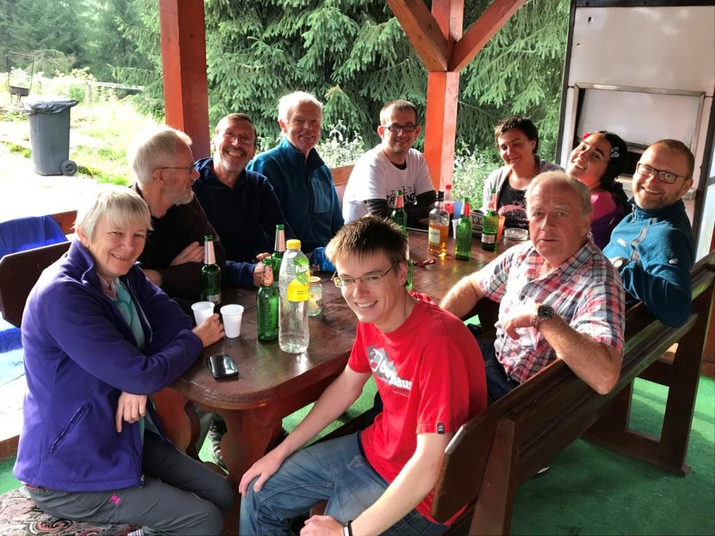
The walking was more challenging than at Padis, reminiscent of Scotland’s rocky ridges and the Pirin Mountains in Bulgaria. Our base was at Cabana Pietrele beside the Stanisoari river. The accommodation in small two-bed huts was basic, but the food and drink served in the main hut was good with a limited menu. Just don’t offer any of us an omelette or a pork escalope for a few months!
The Cabana generator was run from 8 to 10-ish in the evening for lighting and mobile phones could be charged. Helen and Michael, visiting before the start of the official meet remarked upon the taciturn, not to say severe guardienne who presided over things. They challenged the others to get a smile out of her; Richard Taylor, sure of his ability to charm the birds out of the trees was confident. He failed, unless you count a brief twitch of the edge of a lip. However, her mother was visiting that week and they were able to capture her beaming smile with ease.
With camping nearby and an adjacent villa, Pietrele was busy all week with good-natured hikers and backpackers of all ages from Romania, Hungary and the Czech Republic, but we were the only English visitors. All paths were well signed and waymarked (some might say too well waymarked in places).
Fortunately the weather was good, with just one afternoon thunderstorm when we were safely down in the valley. The forecasting apps that we consulted were completely unreliable for Retezat weather.
We saw several marmots (introduced to the Retezat in 1973 from the Austrian Alps), chamois, black squirrels, an eagle, several kestrels, lots of frogs, plenty of butterflies and just one horned viper.
4th August: Travel from Padis to the Retezat Mountains
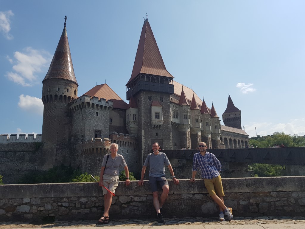
Anca, Jason, Mick and Richard Taylor drove to Deva and met up with Esther Chadwick and Lloyd de Beer at the moated medieval Corvin Castle in Hunedoara, one of the greatest fortresses in Romania.
5th August: Carnic – Cabana Pietrele
After an excellent breakfast at our guest house, we drove from Deva to the roadhead at Carnic village. After paying our 10 Lei access fee for the week to a National Park ranger, we backpacked up the rough access track for a couple of hours to our base at Cabana Pietrele.
6th August: Cabana Pietrele – Varful Retezat
We decided to climb the Park’s eponymous summit first by its long north ridge with its many boulder fields. We were first into breakfast at 7am to get an early start. We started in sunshine and toiled through the dwarf pines up the steep slope to the ridge proper continuing over large lichened blocks and over the north and south summits of Varful Lolaia to the Varful Retezat (cut-off peak) at 2482m.
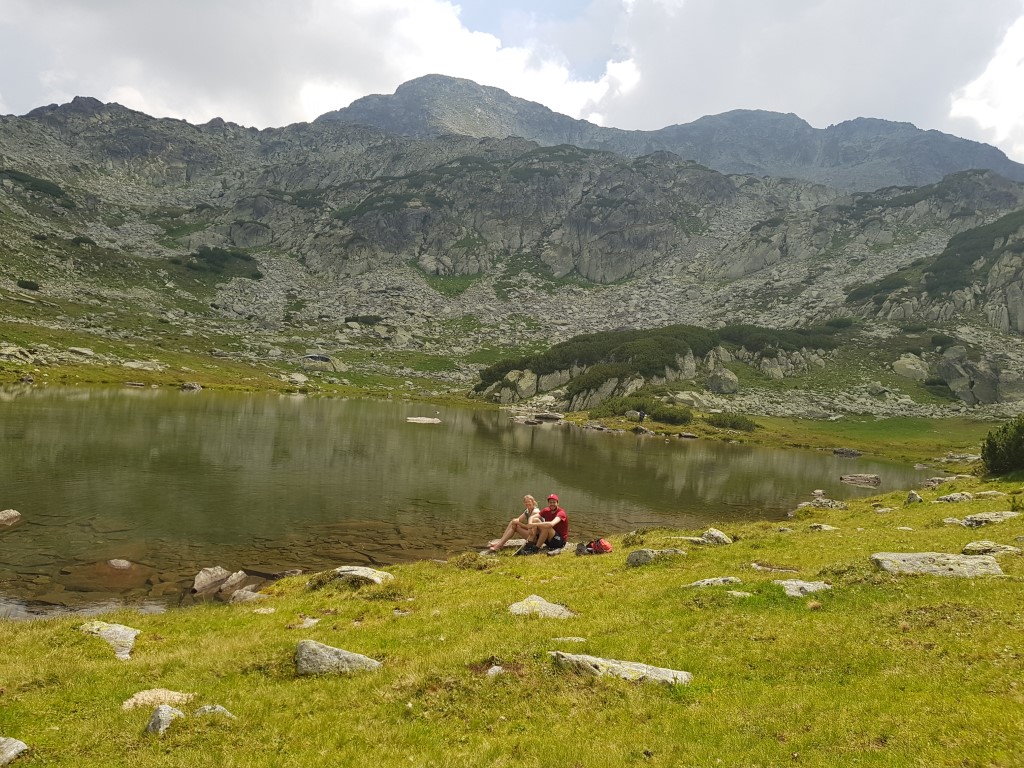
The view across to the main ridge was inspiring as we identified the various summits from the map. We descended south to the Saua Retezat col and down to the clear waters of Lacul Stanisoari and spotted a herd of seven chamois, then back down the valley path to the hut.
7th August: Cabana Pietrele – Varful Mare
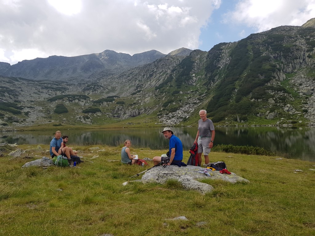
The most eastern peak we could reasonably access was Varful Mare (big peak) 2463m and this was our objective for the second day. Another early start saw us in the spruce fir forest going up and down the moraine remnants now deeply dissected by the rivers draining the Pietrele, Rea and Galesului valleys. Gaining the latter, we progressed up the valley to Lacul Gales, a sizeable glacial tarn.
A steep climb up to the Saua Vf. Mare col led to a rocky scramble up the south ridge to the summit and another great view.
Our eyes were drawn to the jagged crest of the Portile Inchise (Closed Gates) linking the col below us to Vf. Pelusa the second highest peak in the Retezat. A difficult path was indicated on the map and we watched two hikers appear and disappear as they scrambled along the route, which we planned for later in the week. We returned by the same route, spotting some marmots above the lake and admired the flock of 35 rams in fine condition after their summer of grazing the alpine pastures. Near the end we crossed the stream for a small diversion to visit the small Taul dintre Brazi tarn to complete another varied and enjoyable day.
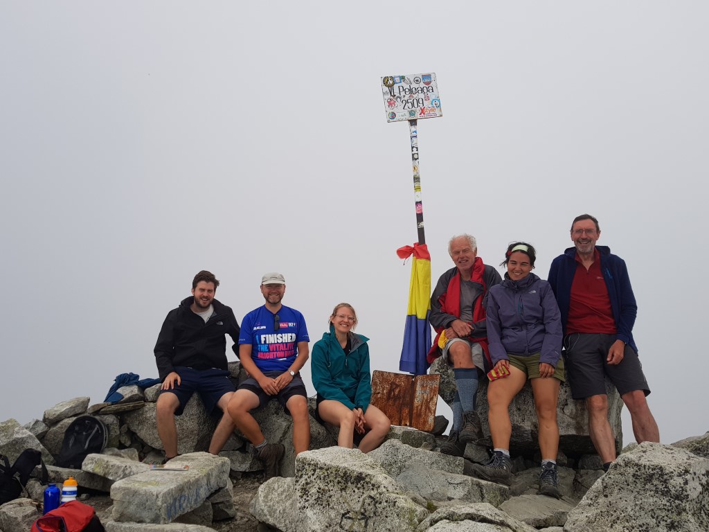
8th August: Cabana Pietrele – Varful Peleaga
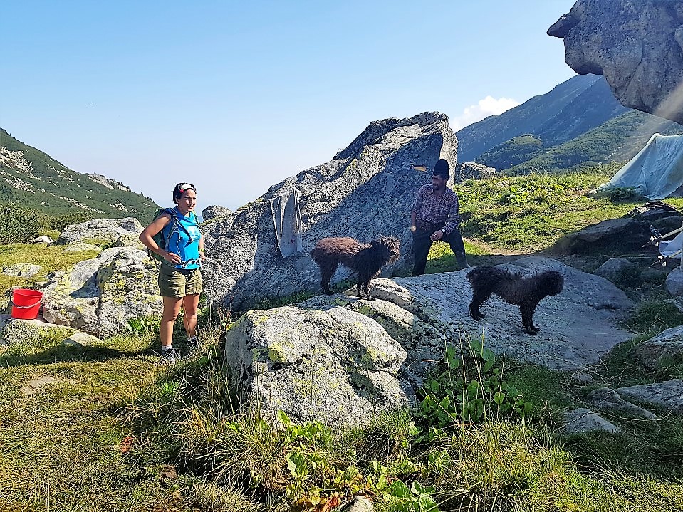
Another benefit of being first into the dining area was that we got the last of the hut’s bread that morning and were able to make sandwiches for our lunch. The hut was resupplied form Carnic using an outsized tractor to transport, but the hut guardian Paul assured us he had plenty of beer! Our intention for the day was to climb Varful Peleaga, the highest summit in the Retezat and the third highest in Romania at 2409m. Our route took us up Valea Pietrele past Cabana Gentiana, a picturesque small wooden mountain hut owned by the Romanian Mountain Club. Just above the hut was a large boulder with poignant memorial plaques to a number of their members killed in the mountains. At Bordul Tomii, a sizeable overhanging shelter-stone near Lacul Pietrele, we met a very friendly Romanian and his dogs tending a herd of cows for the summer. He was sporting a fine black domed hat and a traditional wide leather belt.
At the Curmatura Bacurei col we met a lady with a Siamese cat. The Doberman accompanying a fell runner coming down the slope thought all his birthdays had come at once, but the lady was too quick for him and scooped the cat up out of harm’s way and back into her rucsac. After this entertainment, we traversed the next peak Varful Custura Bacurei and summited Peleaga for lunch to enjoy the fine view over the Bacura lakes to the south.
The mist came and went, but it was a dry descent down the Valea Rea (Bad Valley) back to the Cabane.
9th August: Cabana Pietrele – Varful Bacura I + II
The unvisited western section of the main ridge was next, and we ascended by Monday’s descent route up the Stanisoari valley and along the ridge traversing Varful Bacura I 2433m and then its lower rocky sister. The skies began to darken to the north as we descended into Valea Pietrele and a thunderstorm started peppering Lacul Pietrele with massive water drops. Fortunately, we were close to the Bordul Tomii stone and took shelter, with a discussion about spark gaps and previous close encounters with lightning.
10th August: Cabana Pietrele – Varful Papusa and the Portile Inchise ridge
The last section of the main ridge previously seen from Varful Mare waited for our last day on the hill. We ascended Valea Rea under blue skies passing a sizable flock of sheep and their two shepherds to reach the Saua Peleaga col. We then turned east to climb Varful Pelusa 2408m, the Retezat’s second highest summit for lunch, with thin mist patches blowing in and out of the ridge adding visual interest. At the summit there was a plaque dated 4th August 1968 commemorating the Romanian miners 100th anniversary.
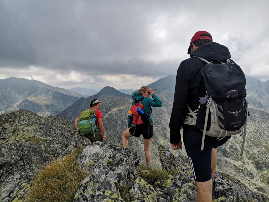
The less experienced members of our party viewed the next section along the 600m long Portile Inchise ridge with some trepidation. A cabled section was descended, then a long ascending Grade 1 scramble with some exposed sections was taken carefully and all enjoyed the airy route, especially Lloyd who had never scrambled before.


At the Saua Vf. Mare col, we saw an eagle soaring above us and then dropped into the Galesului valley, pausing to watch the antics of three marmots before reaching Lacul Gales for a breather. Then the now familiar routine of the descent through the dwarf pines into the comparative cool of the spruce fir forest back to the Cabane for a celebratory beer.
11th August: Cabana Pietrele – Carnic
We said our goodbyes to the hut warden Paul and left our cabins to walk back down the hill to our car at Carnic. We then drove to Sarmizegetusa to visit the partly excavated ruins of Ulpia Triana, a sizable city which was the former Roman capital of Dacia. After wandering around the large amphitheatre, gladiator school, temples and forum etc in 35° C temperatures, we retired for a late lunch and went our separate ways to return to the UK.
Conclusion
The concept of visiting two contrasting upland areas of Romania worked very well and allowed people to come for just one of the weeks. The leader, Anca Pordea, a native Romanian, had ensured the meet went like clockwork and all were very grateful for her detailed planning, local knowledge and the hospitality of her sister Dana and partner Sorin who came along on week one.
The Padis Plateau guarded most of its secrets under a cloak of trees, but the karst features we visited were world class and the Cetatile Ponorului dolines, the Cheile Galbenei gorge and the Cheile Somesului Cald with its dramatic start with a through trip of Pestera Radesei cave were exceptional and highly enjoyable. The cavers who visited the depths of the Cetatile Ponorului river cave were impressed.
The Retezat Mountains were also a great place to visit and have many similarities with more familiar parts of the Pyrenees, such as the Aigüestortes National Park and Andorra which are also glaciated granite sprinkled liberally with tarns and lakes.
Each area had enough for a full week’s activity, but little more and so were a good choice for the trip. Romania is still a comparatively inexpensive place to visit, with a variety of flight options from the UK. The accommodation was modern in Padis and basic but adequate in the Retezat. We ate well – the food provided was plentiful and appetising. The fruit tea and local beers were excellent!
Participants
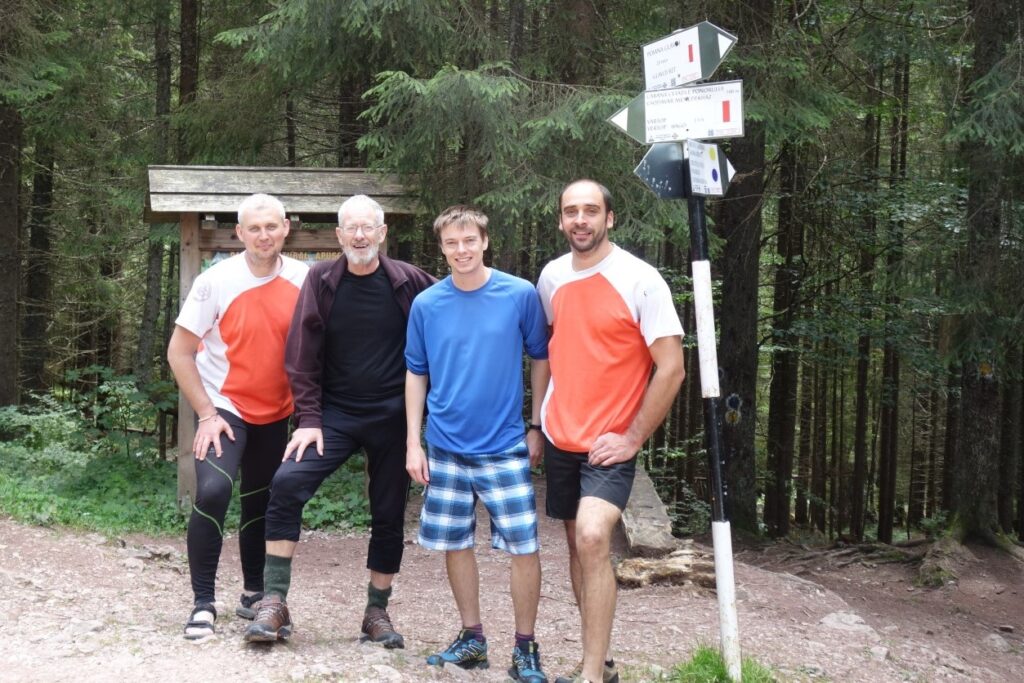
Week One: Mick Borroff, Tim Josephy, Jason Lees (G), Anca Pordea (leader), Helen Smith, Michael Smith, Richard Smith and Richard Taylor.
Week Two: Lloyd de Beer (G), Mick Borroff, Esther Chadwick (G), Jason Lees (G), Anca Pordea (leader) and Richard Taylor.
Maps
- Dimap: Padis Karst Area of Bihor Mountains, 1:30,000
- Muntii Nostri: MN17 Bihorului Platoul Padis, 1:55,000 and 1;25,000
- Muntii Nostri: MN06 Retezat, 1:50,000
- Bel-Alpine: Retezat Mountains, 1:50,000
Mapping Apps
- Avenza maps: Zona Padis din Muntii Bihor (£1.99)
- Galileo Pro: Romania (£3.99)
- Muntii Nostri: Retezat map (free)
Guidebooks
- James Roberts, The Mountains of Romania, Cicerone, 2005. This is the only English language guidebook available and focuses exclusively on backpacking through hikes and was only of limited usefulness for planning our walks. The last decade has seen much change in Romania and the book’s planning section is becoming somewhat outdated.
thank you for making this article very useful and keep up the good work