Out and Around in Australia
Richard Gowing
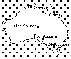
After a week, in September 1997, with my cousins on their farm in Victoria we joined a 31-day camping safari coach tour operated by Australian Pacific, entitled “Red Centre, Darwin and Barrier Reef”. Although this did not entail any particularly energetic or adventurous outings, the coach using only tarmac or major dirt roads, we did pass right through the middle of Australia from Port Augusta to Darwin and across via the gulf of Carpentaria to Cairns, giving us a good feel of the size of the country and the sparseness of habitation in the Outback.
We enjoyed the sunset and dawn colours on the great sandstone monolith of Ayers Rock, but high winds prevented us from making the ascent, the route being closed by the park ranger as unsafe. Walking half-way round the base partly compensated for this disappointment, the rock formations and Aboriginal paintings being well worth seeing. I passed a quiet pool at the foot of a steep rock wall where a young Aboriginal was sitting quietly, as she said, taking in the abundant energy of the place. Ayers Rock, or Uluru to the native people, is very sacred to them and they prefer people not to climb it.
The Olgas or Kata Tjuta, 25 miles west of Ayers Rock, are a jumble of sandstone conglomerate lumps, the highest of which, Mount Olga, at 1069 feet is 200 ft higher than Ayers Rock. This again is an Aboriginal sacred area, and ascents are forbidden, though there are some interesting walks among the lumps. We did the half-hour Olga Gorge walk, following the creek up nearly to its source below the col between Mt. Olga and Mount Walpa, very impressive between the sheer conglomerate walls.
To the east of Ayers Rock we had good views of the third of these sandstone mountains, 2,500 ft Mount Conner. This is a plateau surrounded by 300 ft cliffs above a 500 ft high talus, not often visited by tourists; there is an account of an ascent of it, with a visit to Ayers Rock and the Olgas, by M. Hosford in AJ Vol. LXVII (1962) page 313.
Moving towards Alice Springs we travelled below the escarpment of the George Gill Range to Kings Canyon, a fine gorge which runs south-west out of the range. The rock is Mereenie Sandstone which is porous and holds water, supporting a wide range of relict plants – in fact it has, in places, much of the appearance of karst. We did the two tourist walking routes, starting before lunch with the one-hour Kings Creek Walk which follows the stream up towards the waterfall at its head, flowing out of the “Garden of Eden”, with many attractive trees and plants including ghost gums and desert oaks. (The early settlers tended to name plants and sometimes animals after those with which they were familiar in the “old country”.) The path ends at a pretty rock pool near the canyon head, with cycads growing nearby and fine views up the canyon walls. After lunch at our nearby campsite we did the 2½ hour Kings Canyon Walk, which climbs up to the plateau on the north rim of the canyon which we followed to the oasis of the “Garden of Eden”, lush and green with pools surrounded by cycads, ghost gums, pandanus palms and other tropical plants. This is crossed by a boardwalk which returns to the desert environment of the south rim, which we followed, with impressive views of the sheer north wall of the canyon, to the edge of the escarpment where the path leads back down to the start.
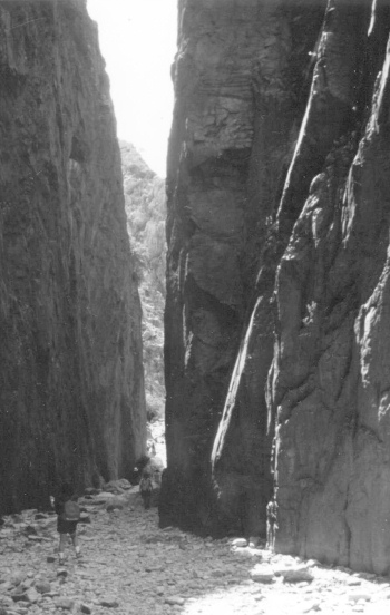
On the way from Kings Canyon to “The Alice” we passed below the Western MacDonnell Ranges, which are the highest hills west of the Great Dividing Range, with Mount Zeil at 1510 m. the highest in the Northern Territory. These are penetrated by a number of gaps or nicks; we visited the Standley Chasm, a dry gorge which cuts through the main ridge with high cliffs as little as 2 metres apart; among the talus at its entry we saw rock wallabies. Further on we visited Simpson’s Gap which is blocked by a pool, and entered Alice Springs through the Heavitree Gap, which the Stuart Highway shares with the “Ghan” railway and the Todd River; the following day we sampled camel-riding in its dry bed – there are some good expeditions to be made by this mode into the desert outback.
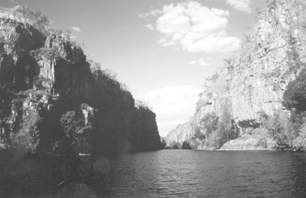
Further up the Territory, after a long day-and-a-half’s drive of some 760 miles, towards the end of which we passed one of Australia’s isolated areas of karst, with the Cutta Cutta Caves noted for wildlife, we came to the Katherine Gorge. This, with nine stretches separated by rock bars, offers up to twelve km of canoeing between high sandstone cliffs, with fine scenery and interesting wildlife and Aboriginal rock paintings; our “taster” consisted of a trip in flat-bottomed motor-boats up and down the first two, which are separated by a nice little walk past some good rock paintings. The campsite is pretty, with wallabies and other small kangaroo-type creatures; we had our only direct encounter with a snake when Elizabeth trod on the tail of a 2 metre tree-python while on the way to the facilities. We can speculate who got the biggest shock!
The northern part of the Territory includes the Kakadu National park, with wetlands of world importance teeming with saltwater crocodiles (the nasty sort) and a wide range of birdlife. We had a beautiful view of this area when we climbed up onto the Arnhem Land escarpment, in itself very pretty with extensive sandstone plateaux and escarpments.
Travelling from Darwin to Cairns through the Barkly Tableland via the Gulf of Carpentaria, we passed through the Atherton Tableland which forms the northern end of the Great Dividing Range. This, the world’s second-longest mountain range, keeps not very far from the east coast, down through Queensland, with the spectacular monoliths of the Glasshouse Mountains (David Atherton could probably fill us in on these), into New South Wales with the Blue Mountains, past Canberra to the Snowy Mountains, Australia’s highest hills culminating in 2228m. Mount Kosciuszko, and then running through the “Victorian Alps” to end at the coast with fine cliff scenery. Our member Tony Reynolds lives near this southern end, among the “mountain ash” forests of the Dandenongs.
After our tour we hired a car at Albury airport and drove up the Murray to follow a forest road through the northern end of the Snowies to the little fishing resort of Adaminaby. From there we spent a day at Yarangobilly, a forested area of karst housing some very fine show-caves. There are quite a number of caves which one can visit as tourists, some guided, some “self-guided”. We joined a guided tour of the Jersey Cave, full of very fine formations of every kind, well lit and explained. A particular feature of the caves in this part of the world is the effect on them of the bush fires, which periodically deposit layers of soot on the formations. We also did a “self-guided” cave, the Glory Hole. This is entered through a fine arch, reminiscent of Marble Arch but on a much bigger scale. The route is provided with low level lighting supplemented by high intensity lights activated by one’s passage through, and gives the satisfaction of a through route which emerges unobtrusively at the carpark. Another attractive feature of this park is a thermal pool; unfortunately the day was rather wet and cold so it held little attraction even if we’d had the time.
From Yarangobilly we drove south to the Snowy Mountains resort of Jindabyne. This quite pretty resort was relocated some years ago when the Snowy River was dammed to form Lake Jindabyne, beside which it now lies. It is well provided with accommodation of various grades, a fine park visitor centre and a good selection of outdoor gear shops.
We drove to Thredbo, the main ski and walking resort. The disaster area was still unrepaired and barriered off pending the completion of the inquiries and inquests. We rode up on the Crackenback chairlift to the “Eagles Nest” on the edge of the valley and followed a mesh pathway, slightly elevated to allow the vegetation to flourish uninterrupted beneath, towards the lookout which gave us a good view of Mount Kosciuszko and the uplands which feed the Snowy River. Parts of the pathway were snowcovered and, without ski or snowshoes, it was not practicable for us to complete the four mile walk, which is easy when clear of snow, to Australia’s summit.
Our final few days in Australia were spent with YRC member Tony Reynolds and his wife Doreen who live in the upper Yarra Valley, not far from Melbourne at the edge of the forests of the Dandenongs, the tail-end of the Victorian Alps. These forests consist largely of Eucalyptus Regnans or Australian Mountain Ash which, growing to 100 metres high, is the tallest species of gum and the world’s tallest hardwood and flowering plant. Tony drove us along some of the forest roads and we sampled some short walks, following trails among the tree ferns for which the Mountain Ashes provide the necessary shade.
Our trip concluded with visits to the Healesville Animal Sanctuary where we were able to see all the Australian birds and animals in a natural setting, and to Sovereign Hill at Ballarat, an open air “living history” museum covering gold-mining in the way that Beamish deals with the life and industry of north-east England.


