Table Mountain
Bill Todd
‘Yes sir, you can get a taxi to the Lower Cable Station’ and ‘but we don’t want to use the Cable Car we want to walk up. Can you supply a map showing the footpaths?’
Out intention to ascend the mountain on foot created a certain amount of consternation in Cape Town’s Tourist Advice Centre early in the November of 1997. However we got a footpath map on the ground floor and found out where the taxi rank was.
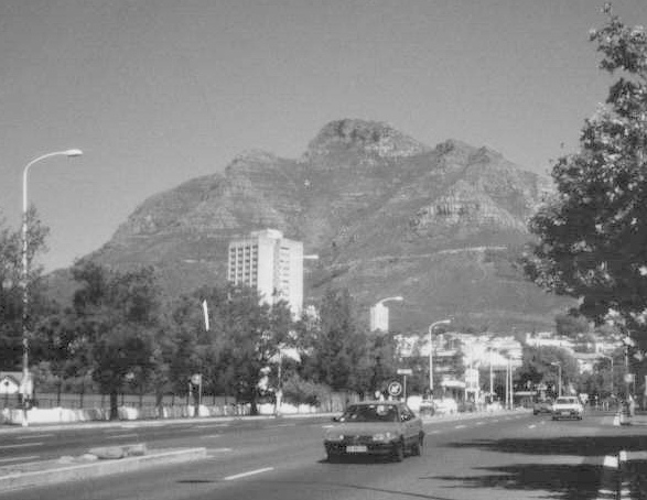
I had a Table Mountain Guide book, published in 1944, but the difficulty was connecting the streets of Cape Town with the paths on its sheltering mountain. With adequate maps Juliet and I believed we could have walked up the mountain from our Hotel, the Holiday Inn, Garden Court de Waal. But the mysteries were such that we thought it best to get a taxi to the starting point of our walk.
‘John and I went up by something klip Gorge’ said my friend Gordon a couple of weeks before we went. ‘People were a bit surprised at our having done it but it wasn’t that bad’. Study of the map indicated that Gordon and John had gone up by Platteklip Gorge, little information as to degree of difficulty was given in our guide. From a man who could out-climb me in Wales and Lakeland forty years ago ‘not too bad’ might be quite testing.
But we only had one day left in Cape Town so we got a taxi and explained to the driver that we wanted to be taken a mile east of the Lower Cable Car Station. I was a bit unhappy when he took third exit at the roundabout above the city. But he was on his native heath and it took Juliet’s self confidence to challenge him, ‘Hey, you’re going to Signal Rock’. Deliberately or not he had misunderstood us so we got him to turn round and drive past the Lower Cable Car Station to the start of the Platteklip Gorge walk at 365m above the sea.
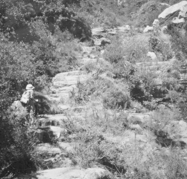
Our testing journey started with a well engineered path of stone blocks, quite sylvan really with green bushes on both sides. It was very pleasant and we wondered how long it would be before we got onto the real rough stuff, this in spite of a notice warning us not to create erosion by wandering off the path.
A stream came down on our right with little cascades and pretty flowers. The path was steep but continued to be firm and safe. We did not enter the gorge proper until half way up when the path bends to the right. You get the best view of Cape Town and Table Bay before this bend and then you are walking under the precipice of Platteklip Buttress. I am pretty sure there are climbs on this but there were none described in our book. Bentley Beetham was in South Africa in the thirties and I am convinced he wrote up some routes he had made in the Fell and Rock Journal. Be that as it may, some young climbers on top of the cliff were offering supervised abseils to the general public at 100 rands a time (7.9 rands to the £ then). Two young ladies abseiled down as we walked up and caught us up on the path glowing with pride of conquered fear. Our path kept on being good and easy to follow right to the top of the gorge.
On the plateau, not absolutely flat but a bit undulating, we found a signpost pointing left to MacLear’s Beacon, the summit, and right to the Upper Cable Station. We had to take the former, of course, which is just over a mile as the crow flies. The path was easy to follow over the rocky surface and we noticed for the first time the strong north west wind. The views of the Cape Peninsula were magnificent. We had driven round it the day before and we could see Hout Bay where we had taken a boat trip to Seal Island. Cape Point was further south but quite distant west of False Bay.
The summit cairn was up a little scramble not unlike Simon’s Seat and when we had had a look round it seemed like a good idea to go back as clouds were welling over the middle plateau to join the smoke of a bush fire by Kirstenbosch Gardens. This was the hardest part of the day with the north west wind blowing strong and cold right into our faces. We didn’t stop for lunch until we got to the dip before the Western Table. It proved an easy stroll over the rise to the Upper Cable Station where we took the newly installed cable car back.
When we later saw Gordon it turned out that the path must have been considerably improved since his ascent seven years before which had involved a lot of screes and loose stuff.
Even without the cable car assistance the day would have been no more arduous than Snowdon from Pen-y-Pass and a lot easier than Ben Nevis from Fort William. We were very lucky to get clear weather for our one chance of an ascent.


